Another winter wallop is in store for the Chicago area this weekend.
A potentially significant storm has set its sights on northern Illinois, likely bringing several inches of snow just days after much of the area saw between 5 and 8 inches of accumulation this week.
Weather alerts have been issued for several counties ahead of the weekend system.
But how much snow you see and when could depend on where you are.
Here is a breakdown of the forecast and what you can expect:
Friday Afternoon and Evening
Friday looks to be mostly to partly sunny and seasonably chilly with afternoon highs between 27 and 33 degrees with a clear night ahead.
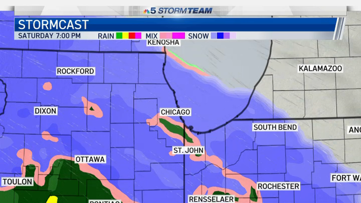
Saturday Morning
Saturday morning, mostly cloudy skies turn overcast as the day grows windy and cold with highs in the low to mid 30s.
Saturday Afternoon
A winter storm watch has been issued for the Chicago area beginning Saturday afternoon.
The watch goes into effect at 3 p.m. Saturday for the entire metro area, including northwest Indiana, according to the National Weather Service. That watch runs through 6 p.m. Sunday for counties north of I-80 and by the lake, but only until 12 p.m. Sunday for those south of I-80 and in the western portion of the region.
While there is still plenty of uncertainty surrounding the storm, early predictions indicate that snow will develop later in the afternoon. It may start as an icy mix initially then become steady heavy snow in the evening.
For far west and southwest locations, just outside of the Chicago metro area, precipitation looks to start between 2 and 4 p.m.
As the storm inches into the Chicago area, west and southwest counties are expected to see the system move in between 3 and 5 p.m.
Areas north and northwest of Chicago and the city itself, along with parts of northwest Indiana, will likely see things begin anytime between 4 and 7 p.m.
Saturday Evening
A period of moderate to heavy snow is expected across the area Saturday night. This is likely when the snow will be its most intense, before things begin to taper off in intensity overnight.
The winter storm watch warns of heavy, wet snow and strong winds that could cause low visibility and snow-packed roads, making travel conditions dangerous.
Sunday Morning
Initial projections show totals could be between 4 to 8 inches by dawn. An icy mix is possible far south toward the Kankakee River Valley which may limit totals.
Though things will lighten during the morning hours, how intense the snow will stay and for how long remains unclear as of Friday. There's likely to continue to be travel impacts during the morning hours.
Sunday Afternoon and Evening
There is again another chance for lake effect snow on Sunday following the storm, which could bring additional accumulations of 1 to 2 inches to areas along Lake Michigan.
The winter storm watch will continue through 6 p.m. Sunday for counties north of I-80 and by the lake, but only until 12 p.m. Sunday for those south of I-80 and in the western portion of the region.
Monday Morning
The lake effect snow could continue into Monday morning, initial forecasts indicate.
The work week will otherwise start off partly sunny, breezy and seasonably cold with the next chance for snow or a light wintry mix possible on Wednesday afternoon or evening.
"much" - Google News
January 29, 2021 at 10:33PM
https://ift.tt/3qXRVN2
Timeline: How Much Snow You Could See and When in ‘Significant' Weekend Storm - NBC Chicago
"much" - Google News
https://ift.tt/37eLLij
Shoes Man Tutorial
Pos News Update
Meme Update
Korean Entertainment News
Japan News Update
Bagikan Berita Ini


0 Response to "Timeline: How Much Snow You Could See and When in ‘Significant' Weekend Storm - NBC Chicago"
Post a Comment